
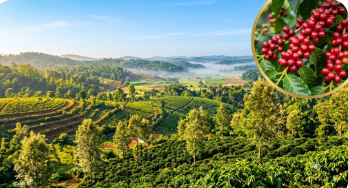
The drive from Bangalore to Madikeri is itself an agricultural education. For a first-time Coorg farmland buyer, the five to six hours of driving from urban Karnataka to the Western Ghats offers a continuous visual narrative of how the landscape changes as you approach one of India’s most distinctive agricultural regions. Learning to read this landscape from the car window is preparation for the sharper, closer reading of the specific estate you will visit.
Bangalore to Mysore: The Urban Fringe and Deccan Plateau
The first ninety minutes of the drive — from Bangalore through the expressway to Mysore — passes through the agricultural transition zone that begins just beyond the city’s southern boundary. The landscape is flat, the vegetation sparse, the agricultural fields typically in dryland crops or fallow. This is the edge of the Deccan plateau — moderate rainfall, moderate soil depth, the kind of agricultural land that Karnataka’s northern interior districts extend across hundreds of kilometres.
Notice what agriculture looks like here: seasonal crops, irrigation-dependent cultivation, the visual signature of water-constrained farming. This is not what you are buying in Coorg, but seeing it provides a calibration reference for the landscape transformation ahead.
Mysore to Kushalnagar: The Cauvery Basin
Beyond Mysore, the landscape becomes more fertile — deeper soils in the Cauvery basin, more intensive cultivation, sugarcane fields replacing dryland crops. The roadside agriculture becomes visibly more productive. This zone reflects the Cauvery river system’s groundwater recharge and the agricultural fertility of a river basin system.
This is the beginning of the landscape shift that culminates in Coorg’s Western Ghats character. By Kushalnagar — the town that marks the entry point to Kodagu district — the landscape is already greener and more intensely cultivated than the plateau behind you.
Kushalnagar to the Ghats: The Transition
The stretch from Kushalnagar through the Cauvery valley before the ghat ascent is where the Western Ghats’ agricultural character begins to assert itself. The air becomes more humid. The vegetation along the roadside becomes denser. The first glimpses of coffee and arecanut cultivation appear in the smallholder plots along the road.
Watch for the elevation change indicator: the moment when the road begins to climb the ghat face, the landscape on either side transforms with a speed that makes the altitude-climate-vegetation relationship viscerally obvious. Within fifteen minutes of beginning the climb, you move from the relatively open Cauvery valley to the dense, moist, coffee-covered Western Ghats slopes of Kodagu district.
Reading the Coffee Landscape From the Road
As you drive through Coorg’s agricultural zones after ascending the ghats, the coffee estates on either side of the road teach you what well-managed versus poorly managed estate land looks like from a moving vehicle.
Well-managed estates: uniform green coffee canopy at consistent height between the rows, well-maintained shade canopy of silver oak at appropriate density, clear drainage channels along the road edge, tidy appearance with no excessive undergrowth between the rows.
Poorly managed estates: irregular canopy with visible gaps indicating dead or diseased plants, over-dense shade canopy suggesting skipped pruning, rank undergrowth between rows indicating inadequate weed management, general appearance of inattention.
This roadside reading gives you a calibration for what estate health looks like visually before you walk your first specific plot — and the differences are observable from a moving car at road speed once you know what to look for.
The Altitude Reading
As you climb through Coorg, your phone’s GPS altitude reading tracks the elevation change. Make a habit of checking altitude at various points along the route — you quickly develop a physical sense of what nine hundred metres feels like (still warm, coffee-growing but lower quality), what eleven hundred metres feels like (cooler, the beginning of the prime specialty zone), and what thirteen hundred metres feels like (the temperature of genuine premium Arabica quality).
When you visit specific estates, you will immediately have a calibrated physical sense of whether the altitude matches what the documentation claims.
Arriving at Madikeri
Madikeri town — the district headquarters — sits at approximately twelve hundred metres. Arriving there after the ghat ascent, the air is noticeably cooler than Bangalore and the landscape noticeably greener and denser. The town’s compact, hill-station character — different from any Karnataka plains town — signals that you have arrived in a genuinely distinctive landscape.
This is the destination your investment inhabits. The specific quality of light, air, and landscape that you have driven through is the permanent context of the estate you are about to visit.