
Water availability is the single most important determinant of agricultural land viability over a long investment horizon. As India faces growing groundwater depletion in many major agricultural regions, the question of whether a specific farmland investment zone has structural water security is increasingly critical. Near Mysore, the answer is more reassuring than for most Karnataka agricultural zones outside the Western Ghats.
The Cauvery System’s Role in Mysore’s Agricultural Water
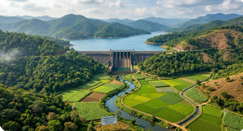
The Cauvery river and its tributaries — the Kabini, the Hemavathi, the Shimsha, and the Lokapavani — form a water network that flows through or near most of the Mysore district’s productive agricultural zones. Three major reservoirs on this system — Krishnaraja Sagara (KRS) on the Cauvery near Mandya, Kabini reservoir near H D Kote, and Hemavathi reservoir in Hassan district — store monsoon water and release it for irrigation through the canal networks serving Mysore and Mandya districts.
This reservoir-fed irrigation system provides a level of water security that purely groundwater-dependent agricultural zones cannot match. Even in years when the monsoon is below average — reducing groundwater recharge and bore well yields across most Karnataka agricultural areas — the reservoir system provides some regulated flow to canal-served areas of the Mysore agricultural belt, maintaining a minimum agricultural water supply that dry-land farming zones lack entirely.
Bore Well Depth and Yield in the Mysore Agricultural Belt
The Cauvery river system’s perennial flow and the reservoirs’ storage contribute to groundwater recharge in the surrounding agricultural land — maintaining water tables in the Mysore agricultural belt at levels that support productive bore well yields across most of the district. Bore wells in the Mysore agricultural zone typically reach productive water at sixty to one hundred and twenty metres depth — moderate depth that reflects reasonable groundwater tables rather than the depleted aquifers requiring two hundred to three hundred metre drilling that characterise some Deccan plateau farming districts.
For managed farmland investors, this groundwater depth profile means that bore well irrigation is practically viable at reasonable cost — the infrastructure investment in submersible pump sets and piping is not disproportionate relative to the irrigation benefit delivered.
The Seasonal Distribution of Water Near Mysore
Mysore district receives the majority of its nine hundred to twelve hundred millimetres of annual rainfall between June and October, with a secondary contribution from the northeast monsoon in November. The dry season from December through May is when irrigation matters most — and it is during this period that the reservoir system’s managed releases and the groundwater recharge from the monsoon are the primary water sources for agricultural production.
Nature N Me’s managed farmland near Mysore includes drip irrigation infrastructure on all plots — ensuring that the available water from bore wells is delivered efficiently to crops during the critical dry months rather than being lost to surface evaporation from flood irrigation.
Comparing Mysore Water Security to Other Karnataka Agricultural Zones
Mysore’s water security is not at the level of Coorg’s Western Ghats zone — where orographic rainfall of two thousand five hundred millimetres plus perennial streams makes irrigation almost supplementary rather than essential. But it is significantly more reliable than Karnataka’s northern and central Deccan plateau agricultural districts, where groundwater depletion is a documented and worsening problem.
The Mysore district’s position in the Cauvery river system catchment, with reservoir storage providing regulated seasonal water and moderate groundwater tables supporting reliable bore well yields, places it in the upper tier of Karnataka agricultural water security outside the Western Ghats zone — a meaningful advantage for long-term farmland investment.
Disclaimer: The information provided in this article regarding water availability, river systems, and groundwater tables is for educational and informational purposes only. While the data is gathered from reliable sources, water security and borewell yields can vary based on seasonal changes, exact plot locations, and broader environmental shifts. This content does not constitute formal investment, legal, or agricultural advice. Prospective buyers are strongly advised to conduct independent due diligence and consult with qualified legal and agricultural professionals before making any real estate investments.